The Seismic Hazard Zones Cadastre Service was established based on Resolution No. 152 of the Cabinet of Ministers dated June 30, 2005. The cadastre of high seismic hazard zones is a part of the State Cadastre of “Zones with High Natural Hazards.”
MAIN PURPOSE OF THE CADASTRE SERVICE:
The Seismic Hazard Zones Cadastre is a technical system aimed at identifying, assessing, and documenting the level of seismic activity in certain areas. This cadastre is essential for collecting and systematizing important information to reduce the risk of natural disasters, plan urbanization processes, and carry out safe construction activities. Based on the results of seismic monitoring conducted in the Republic, the main task is to regularly submit data to the NGIS Cadastre for systematic recording.
FUNCTIONAL DUTIES OF THE SEISMIC HAZARD ZONES CADASTRE SERVICE:
The State Cadastre of High Natural Hazard Zones is an integral part of the NGIS, consisting of unified descriptions and images of such zones prepared, regularly updated, and refined as needed, based on systematic observations, research, and information collection results. It also includes data on hazardous natural events occurring each year. The cadastre ensures the registration of cadastral objects, monitoring their condition, and assessing the consequences of hazardous natural (geological, hydrometeorological) processes (events).
The main principles of the State Cadastre of High Natural Hazard Zones are:
• Coverage of the entire territory of the Republic of Uzbekistan;
• Use of system and topographic foundations;
• Application of methodologies for processing and presenting cadastral information;
• Use of automated geoinformation technologies;
• Reliability and clarity of data;
• Transparency of cadastral information.
An agreement has been signed between the National Geoinformation System of the Cadastre Agency under the Ministry of Economy and Finance of the Republic of Uzbekistan and the Geoinformation System of the G.O. Mavlonov Institute of Seismology under the Academy of Sciences, on integrating “necessary cadastral data for seismic risk assessment” and geoinformation data related to “seismic hazard zones” into the geoinformation system, as well as on exchanging such geoinformation data via a secure communication network.
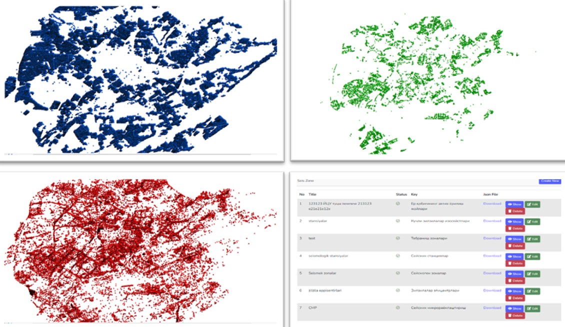
Based on the functional obligations approved in Resolution No. 620 of the Cabinet of Ministers dated October 26, 2022, “On the approval of certain regulatory legal acts regulating the field of spatial data in the Republic of Uzbekistan,” the Seismic Hazard Zones Cadastre focuses on collecting additional data to specify or supplement the thematic layers of the database created in ArcGIS.
Thematic layers include:
1. Seismogenic zones
2. Seismic stations
3. Vibration zones
4. Active faults of the Earth’s crust
5. Earthquake epicenters
6. Isoseists of strong earthquakes (M > 5)
7. Cities and settlements where seismic microzonation works are carried out
CADASTRE SERVICE TEAM:
1. Normo‘minov Mirjahon Sherali o‘g‘li – Head of Service
2. Ahmatullayeva Nargiza Shuxrat qizi – Leading Engineer
3. Nugmanova Aropat Abduraxmitovna – Leading Engineer